History
Museum and church
Around the square
- WalkA few steps
- Best forA short tour stop
- InsideValley archaeology
Locate your stop
Map of 35 stops
First pick a route, then tap any pin or stop for details and Google Maps.
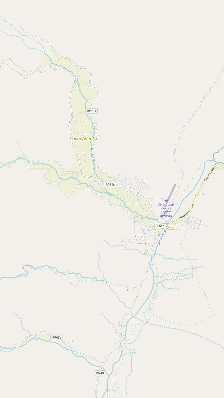
The Pío Pablo Díaz museum, facing the main square beside the San José church.
Google MapsThe street where the wine festival opens with its Fogones del Vino.
Google MapsThe town cemetery, a short walk north of the main square.
Google MapsA hilltop cross north of town with a wide view over the valley floor.
Google MapsThe Star of Hope artwork created 3 km from town, now a viewpoint over the valley.
Google MapsA rural hamlet in the hills west of town, a quiet outing from the square.
Google Maps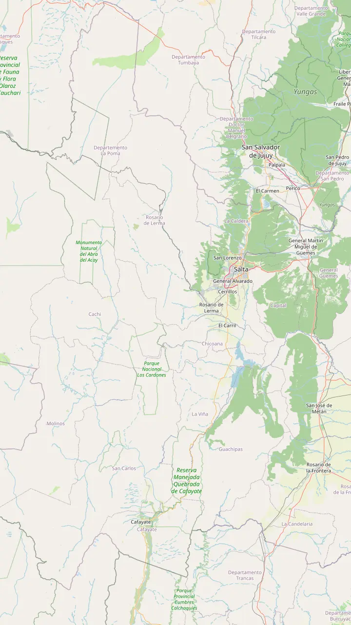
Long-distance coaches from all over Argentina, and the daily buses to Cachi.
Google MapsA Lerma Valley town that the day tour crosses on its way south out of Salta.
Google MapsThe town named after the Chicoana people, deported here from the Calchaquí Valley.
Google MapsThe green gorge that carries Provincial Route 33 up towards the Calchaquí Valley.
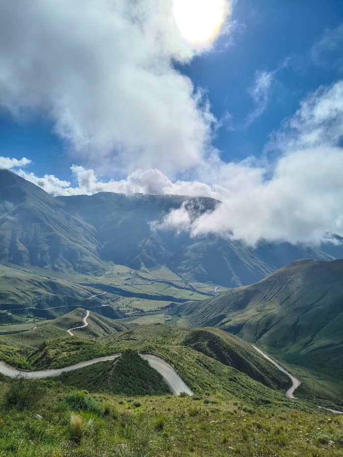
Google MapsThe top of the climb at 3,348 m, with a stone chapel and a broken granite millstone.
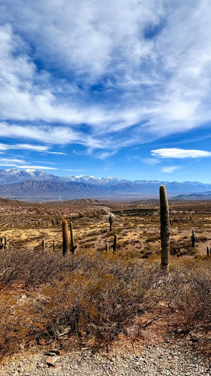
Google MapsThe long straight road across the cactus plain, on the line of an ancient path.
Google MapsThe park's administrative seat, where red peppers dry in the sun on the farms.
Google MapsThe colonial town 162 km from Salta, at 2,210 m.
Google Maps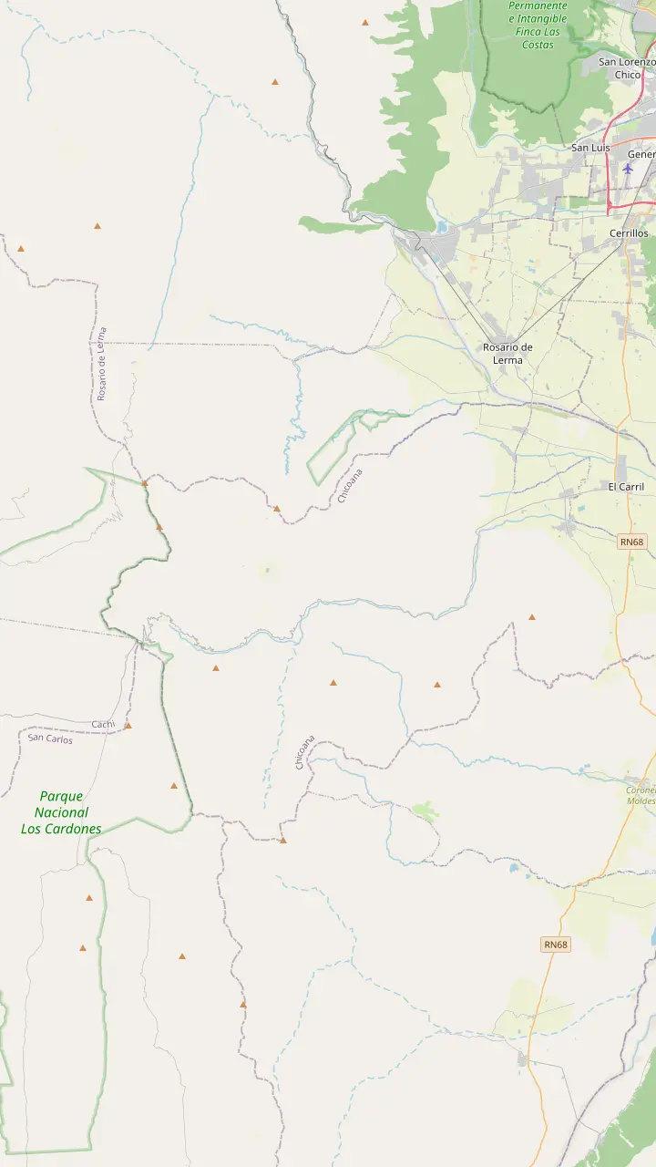
The town named after the Chicoana people, deported here from the Calchaquí Valley.
Google MapsThe green gorge that carries Provincial Route 33 up towards the Calchaquí Valley.
Google MapsEroded rocks, a small lagoon and rock paintings, down a steep side road of 4 km.
Google MapsThe top of the climb at 3,348 m, with a stone chapel and a broken granite millstone.
Google MapsThe high plain you see from Route 33 on the way into the park.
Google MapsThe park's mountain trail, starting at 4,046 m and open from April to November.
Google Maps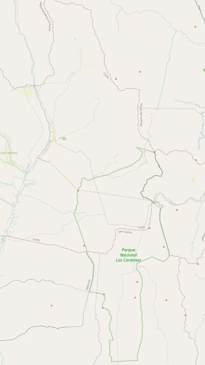
The top of the climb at 3,348 m, with a stone chapel and a broken granite millstone.
Google MapsThe high plain you see from Route 33 on the way into the park.
Google MapsA short path up a hillock beside the road, looking out over the cardones.
Google MapsThe long straight road across the cactus plain, on the line of an ancient path.
Google MapsA churqui forest with the Los Guaipos loop and the Yacoraite campsite.
Google MapsThe park's mountain trail, starting at 4,046 m and open from April to November.
Google MapsThe park's administrative seat, where red peppers dry in the sun on the farms.
Google Maps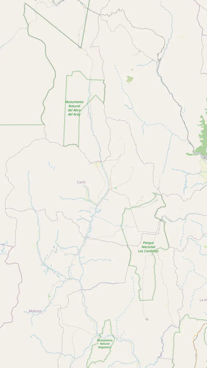
The Pío Pablo Díaz museum, facing the main square beside the San José church.
Google MapsAn archaeological site 12 km from Cachi, facing the snowy Nevado.
Google MapsPre-Columbian ruins in the valley, 14 km from Cachi.
Google MapsThe Star of Hope artwork created 3 km from town, now a viewpoint over the valley.
Google MapsInca shrines and tambos, part of the Qhapaq Ñan World Heritage listing.
Google MapsThe long straight road across the cactus plain, on the line of an ancient path.
Google MapsThe top of the climb at 3,348 m, with a stone chapel and a broken granite millstone.
Google MapsThe highest mountain of the Calchaquí Valleys, the white wall behind the town.
Google Maps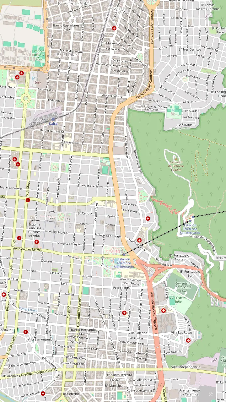
The heart of old Salta, framed by the Cathedral, the Cabildo and the arcades of the historic centre.
Google MapsA National Historic Monument facing the square, home to the sanctuary of the Lord and Virgin of the Miracle.
Google MapsOne of the few almost complete colonial town halls left in Argentina, now a history museum.
Google MapsAn Andean baroque basilica whose bell tower rises 54 m above the street.
Google MapsThe convent whose chapel was begun in 1723, one of the oldest buildings in town.
Google MapsThe high-altitude archaeology museum that keeps the Llullaillaco children, open Tuesday to Sunday.
Google MapsGondolas from Parque San Martín up to the summit, a ride of 10 minutes.
Google MapsSummit gardens and viewpoints, with the cross set up in 1901 and a copper Christ.
Google MapsThe monument to the gaucho general of the independence wars, below the wooded hill.
Google MapsPeñas, bars and regional food along one street, busiest from Thursday to Sunday night.
Google MapsThe historic city market, a good place for a cheap regional lunch.
Google MapsLong-distance coaches from all over Argentina, and the daily buses to Cachi.
Google Maps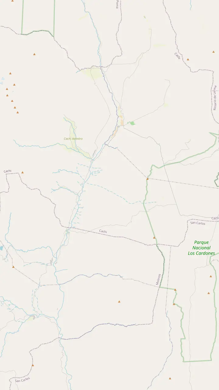
The colonial town 162 km from Salta, at 2,210 m.
Google MapsA rural hamlet in the hills west of town, a quiet outing from the square.
Google MapsPre-Columbian ruins in the valley, 14 km from Cachi.
Google MapsThe park's administrative seat, where red peppers dry in the sun on the farms.
Google MapsA churqui forest with the Los Guaipos loop and the Yacoraite campsite.
Google MapsA valley village reached by Route 42 from the end of the Tin Tin straight.
Google MapsMapping data © OpenStreetMap contributors
What to do in Cachi, Salta, once the bus doors open? Walk the cobbled square, step into an old church roofed with cactus wood, then let the museum explain the valley.
Editorial team, cachitour.click · Updated November 12, 2026 · Reading: 7 min
Every plan for what to do in Cachi, Salta, starts on the main square. The provincial tourism board calls it the center of social life in town, ringed by heritage buildings, the San José church, the Archaeological Museum, bars and shady trees.2 Sit on a bench for a while before you go anywhere, and the slow rhythm of the place will set your pace for the rest of the visit.
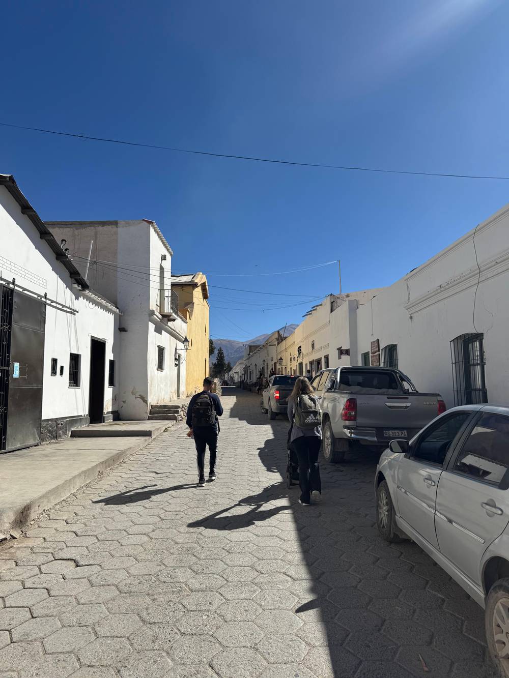
The town grew on Diaguita settlements and then on the old Hacienda de Cachi, and the board stresses how carefully its historic center has been kept.6 The streets wind, and the pavements sit at different heights above the road, so watch your step when you cross.7 The park service adds the details that make a stroll photogenic: thick adobe walls, raised pavements and double doors set into the corners.8
The look is not an accident. Cachi was chosen to represent Argentina in UN Tourism's Best Tourism Villages 2026, a program for places of up to 15,000 people that use tourism to protect their heritage.9,10 The board credits the cobbled streets, the adobe houses and the protected center for that choice.11 Walk a few blocks off the square and you will see why: almost nothing modern breaks the line of the old facades.
Sights at a glance
| Sight | Where | Good to know |
|---|---|---|
| San José church | On the main square | Cardón-wood roof |
| Archaeological museum | Facing the square | More than 5,000 pieces |
| Stargazing site | 500 m from the center | Dark, clear sky |
| Ovnipuerto | 3 km from town | Valley viewpoint |
| Las Pailas | 12 km from Cachi | Views of the Nevado |
| La Paya | 14 km from Cachi | Pre-Columbian ruins |
Locations as published by the province's tourism ministry and the national parks office.2,3,24,25,23,26
The church facing the square is the picture everyone takes home. Its construction goes back to the 16th century, and the national tourism board lists it among the country's protected historic monuments.15 The same board praises its design and its ceilings made from the timber of the giant cardón, the cactus you passed in Los Cardones park.12 Step inside quietly; it is a place of worship, not a museum.
The church is also the heart of the town's year. The feast of San José, the patron saint, begins on 18 March, when families arrive from distant hamlets carrying small images of the saints they keep at home.16 The main day is 19 March, with mass, a procession and a parade of gaucho groups.17 If your dates are flexible, it is the most colorful time to be in Cachi.
Easter brings older customs to the surface. On Good Friday at dusk, residents burn a giant straw figure of Judas on the Plaza Seca.18 Neighbors also stage a living Way of the Cross on the via crucis circuit and at the main viewpoint of the town.19 Visitors are welcome to watch, but these are religious events for the community, so keep a respectful distance and ask before you photograph people.
Up and up
Next door in spirit, and only a few steps across the square, is the Pío Pablo Díaz Archaeological Museum. The provincial culture department says it was created in 1969 from collections donated by Pío Pablo Díaz, and that all of its material comes from the northern part of the Calchaquí Valley.29,27 That local focus is what makes it worth an hour of a short visit.
The collection holds more than 5,000 pieces and lets you follow about 10,000 years of history in the region.3,4 The rooms move from hunter-gatherers through the first farming villages and the regional cultures to the Inca and the early colonial period.30 Only about 30% of what the museum owns is on show, and the rest is kept in its reserve for researchers and temporary exhibitions.31
The building is part of the visit. It was a family house built at the end of the 19th century, with adobe walls and a roof of cane and mud.32 The museum faces the main square, on Juan Calchaquí street.33,34 In the summer holiday program it ran guided visits on Fridays at 12.30, and children's activities from Tuesday to Sunday, so check what is on when you arrive.35,36 Among the attractions of Cachi, Salta, it is the one that explains all the others.
Short on time?
Pick by what you came for, then fill the rest of the time.
If I want the history of the valley
The museum
If I want the classic photo
The church on the square
If I want to taste local wine
Lunch with a local bottle
Vines grow above 2,400 m around the town.5
If I want a view and a story
The Ovnipuerto
A viewpoint over the valley outside town.28
If I have only the tour's free time
Square, church, lunch
The day tour gives you 2 hours in town, from $30.
Pick your afternoon
History
Around the square
Wine
Small local labels
Views
The Star of Hope
Cachi is wine country, and an unusual one. The province bills the town as the home of the world's loftiest wine route, and its vineyards grow above 2,400 m.71,5 At that height the sun is fierce and the nights are cold, conditions that shape the grapes long before they reach a glass. Many bottles on restaurant lists come from small local producers, so ask your waiter which ones were made in the valley around you.
Along the wider high-valley route, Torrontés is the signature white, while Malbec, Syrah, Tannat, Cabernet Sauvignon, Barbera, Bonarda and Tempranillo fill the reds.72 On a short stop the simplest way to taste is over lunch rather than on a winery tour. If you have a car and a free afternoon, ask at the square which small bodegas are open, and never drive the mountain roads after tasting.
Harvest time is the moment to come. The provincial page sets the high-valley harvest festival on the last weekend of March, and the fourth edition in 2026 ran from 10 to 12 April.73,74 It opened with wine fireside evenings on Calle Suárez, gathered more than 20 winery stands in the square and ended with wineries opening their doors.67,75,76 Entry was free, and the official tasting glass cost ARS 25,000.77
Price the trip
Compare day trips from Salta with free time in Cachi.
Compare 3 side by side
Compare day trips from Salta with free time in Cachi.
≈
View≈
View≈
ViewStarting prices on GetYourGuide, exchanged at the ECB reference rate. The booking page gives the exact price.
Free time in town
Arrival
Your 2 hours in town start when you step off the coach.
First stop
Benches, trees and the heritage buildings around you.2
Then
Look up at the cardón-wood roof.12
After that
Thousands of pieces from the valley's past.3
Lunch
Humitas, tamales, locro or empanadas.13
Last minutes
Buy a local bottle or a woven piece on the way.14
Cachi's skies are part of the attraction. The board says the clear air and a dark spot only 500 m from the town center make it ideal for watching the stars.24 Specialists from the Wara Punco foundation and the Galileo Galilei Observatory run educational stargazing sessions here.78 Bring a warm jacket even in summer, because the temperature falls quickly once the sun drops behind the mountains.
Then there is the legend that draws a different crowd. Many people say they have seen flying objects in the sky over Cachi, and the board openly lists the town for what it calls UFO tourism.79 A Swiss visitor once laid out a large stone artwork 3 km from town called the Star of Hope, and today everyone knows it as the Ovnipuerto, the UFO airport.25
Whatever you believe, go for the view. The site works as a natural observatory and a lookout over the whole Calchaquí Valley.28 It is an easy outing by car or a longer walk, best in the late afternoon when the Nevado turns pink. Go with an open mind and a sense of humor: locals tell the stories with a smile, and the sunset is real whatever lands afterwards.
Video
Samuel and Audrey on YouTube · Your tap on play is what loads the video.
Cachi church, across from the square, is a beautiful image because of its architecture and its cardon wood roofs.
In town
The snowy wall behind the town is the Nevado de Cachi, at 6,380 m by the provincial board's figure (a park service page has 6,720 m); it is the highest mountain of the Calchaquí Valleys.21,23,66 Its range is made of 9 summits and attracts serious mountaineers.80 The board advises arranging local guides and following the rules before any climb, and that is not optional advice at this height.81
For gentler days there is plenty of walking. The board describes hills and mountains around town that suit treks of different lengths and difficulty, often mixed with archaeology or wildlife watching.82 Cyclists and drivers have their share too, including several 4x4 routes into the backcountry.83 The town even has a high-altitude training center whose athletics track is used by athletes from the province and beyond.84
A pair of ancient sites make good half-day trips. The park service places the pre-Columbian ruins of La Paya 14 km from Cachi, and Las Pailas 12 km away with fine views of the Nevado.26,23 Of all the things to do in Cachi, Salta, these are the ones that reward a second day, because the mountain looks finest in the early hours and the standard day tour does not stop at them.
Lunch is easy to find around the square. The board notes that adobe houses and colonial buildings with square corners have become restaurants.85 Look for humitas, tamales, locro and empanadas on the menu.13 Most of them start from maize, the base of so many recipes in the province.86 Leave room for dessert: mazamorra, turrón salteño, dulce de cayote and cuaresmillo are the local classics.87
Crafts here are serious work. The board describes the valley villages as keepers of one of the main traditions of weaving on the criollo loom, from blankets and rugs to ponchos and bags.14 Pottery with designs taken from pre-Hispanic ware is also made in Cachi.88 In 2026 the town held its first weaving prize for master weavers working with the waist loom, the pedal loom, embroidery and natural dyes.89
On the classic day tour you get about 2 hours in Cachi, part guided walk and part free time. That is enough for the square, the church and either the museum or a long lunch, not both at a slow pace. If you want stars, wine and the ancient sites as well, treat the day tour as a scouting trip and come back to sleep in town another time. A single night changes the experience completely.
FAQ
The main square holds the San José church and the Archaeological Museum, surrounded by heritage buildings and cafés.2
The classic day tour from Salta gives Cachi about 2 hours, part guided and part free, before the drive back.
Sources
Further reading
Crossing the Bishop's Slope to Cachi? Ask a real person here.